1. Why Montgó Steals Your Heart at First Glance
Wherever you stand in Dénia or Xàbia, the pyramid‑shaped silhouette of Montgó rules the skyline. At just 753 m tall yet rising only a few hundred metres from the sea, it is a natural lighthouse for the Marina Alta. Sheer limestone walls, pine forests, abandoned vineyard terraces and prehistoric caves deliver a concentrated dose of Mediterranean landscape that hooks hikers, photographers and nature lovers. (es.wikipedia.org)
2. Fast Facts
| Item | Value |
|---|---|
| Highest point | 753 m a.s.l. |
| Natural‑park area | 2,117 ha on land + 603 ha marine reserve |
| Protected since | Decree 25/1987 – Generalitat Valenciana (en.wikipedia.org) |
| Municipalities | Dénia & Xàbia (core); Ondara, Gata de Gorgos & Pedreguer in the management plan (es.wikipedia.org) |
| Visitor centre | Interpretation Centre “Bosc de Diana”, Camí Sant Joan 1, Dénia (parquesnaturales.gva.es) |
| Typical opening | Mon/Wed/Fri/Sat 09:00–14:00 (parquesnaturales.gva.es) |
3. Geology: A Cretaceous Limestone Cathedral
Montgó belongs to the Pre‑Betic domain. Cretaceous limestones and marls were folded during the Alpine orogeny, creating a south‑tilted syncline. Karstic rock has sculpted sinkholes, dolines and caves such as the Cova de l’Aigua (used by Romans and Moors for water storage) and the Cova del Camell. (es.wikipedia.org)
Orographic Micro‑climate
The massif blocks humid sea air that rises, cools and condenses, forming a cap of cloud even on sunny days. Expect higher rainfall than the surrounding plain, especially Sept–Nov; summers are long and dry. (en.wikipedia.org)
4. Ecosystems & Biodiversity
4.1 Flora
With 650+ recorded species, Montgó is a botanical laboratory. Highlights include:
- Carduncellus dianius (Montgó thistle), a Dénia‑Ibiza endemic (researchgate.net).
- Silene hifacensis, listed as critically endangered.
- Mediterranean maquis of kermes oak, mastic and dwarf fan‑palm, dotted with Phoenician juniper on Les Planes.
4.2 Fauna
Roughly 150 vertebrate species live here (es.wikipedia.org):
- Bonelli’s eagle (Hieraaetus fasciatus), icon of the park (birding.comunitatvalenciana.com).
- Eagle owl, peregrine falcon, tawny owl and Audouin’s gull on the sea cliffs.
- Mammals: fox, genet, badger and several cave‑roosting bats.
- Reptiles such as the ocellated lizard and Montpellier snake.
4.3 Marine Reserve at Cap de Sant Antoni
Below the eastern cliff lies a seabed of Posidonia meadows, sponges and coralligenous outcrops, frequented by striped dolphins and loggerhead turtles. Snorkelling is superb on calm days—stay outside the buoyed no‑entry zones.
5. Human Footprints & Cultural Heritage
- Cova de l’Aigua: Roman inscriptions (2nd century AD) and remains of a Moorish cistern.
- Casa de Biot: vestiges of an Iberian settlement (8th century BC) on the summit plateau (en.wikipedia.org).
- Les Planes windmills: a line of 18th‑century flour mills overlooking Xàbia.
- Hermitage of Pare Pere (17th c.): trailhead for several walks.
6. Way‑marked Trails
All official tracks are signed white–yellow (PR‑CV). Wear sturdy footwear, carry at least 2 L of water and avoid midday heat in summer.
| Trail | Distance / Ascent | Difficulty | Start point | Highlights |
|---|---|---|---|---|
| PR‑CV 355 “Classic” | 4.7 km one way · +630 m | Hard | Camí de la Colònia (Dénia) | Final ridge, Ibiza views (senders.femecv.com) |
| PR‑CV 355 Xàbia variant | 6.0 km one way · +600 m | Hard | Camí del Coll de Pous (Jesús Pobre) | Abandoned dry‑stone terraces |
| Cova de l’Aigua & Cova del Camell | 3.5 km loop · +250 m | Moderate | Hermitage Pare Pere | Cool caves & natural wall |
| Montgó North‑face (Umbría) | 5 km · +320 m | Moderate | Visitor Centre | Shady maquis & raptor spotting (parquesnaturales.gva.es) |
| Cova Tallada (summer permit) | 1.2 km one way · ±125 m | Mod–Hard (equipped) | Torre del Gerro (Dénia) / Les Rotes | Sea cave carved in rock, crystal swim; permit required 12 Apr–05 May & 15 Jun–15 Oct (parquesnaturales.gva.es) |
Hiking tip: For solitude, start at dawn on the north face; orographic clouds usually clear by noon, gifting clear panoramas on the descent.
7. Visitor Services
- Interpretation Centre “Bosc de Diana” with geology & wildlife displays (Mon/Wed/Fri/Sat 09:00–14:00) (parquesnaturales.gva.es, parquesnaturales.gva.es).
- Free parking at the centre and the Les Planes recreation area.
- Drinking water only at the base (Camí de la Colònia). No water on the summit.
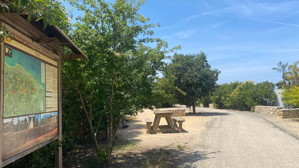
- Picnic zones at Les Planes (windmills) and the Pare Pere rest area.
Park Rules in a Nutshell
- No fires or camping.
- Dogs on a leash at all times.
- Do not pick plants or alter formations.
- Drone flights require park authorization.
8. Best Seasons & Photo Tips
- Spring: rosemary bloom and crisp skies.
- Autumn: fiery sunsets and thinner crowds.
- Winter: maximum visibility, occasional frost on top.
- For iconic shots, head to the Cap de Sant Antoni viewpoint at sunrise, or hit the classic route 30 min before dawn to capture nautical blue light.
9. Where to Go Next
After the descent, recharge with a grilled red prawn in Dénia or drive to Xàbia for a dip at Cala del Tangó. Craving more peaks? Try the nearby Serra de Bèrnia ridge or cycle through the vineyards of the Jalón Valley.
Epilogue
Montgó is more than a mountain; it is a vertical synopsis of the Costa Blanca. A single ascent reads millions of years of geology, centuries of human history and a living lesson in Mediterranean adaptation. Treat it with respect and you’ll return with memories—and SD cards—packed with moments that never expire.
See you at the summit! 🏔️


